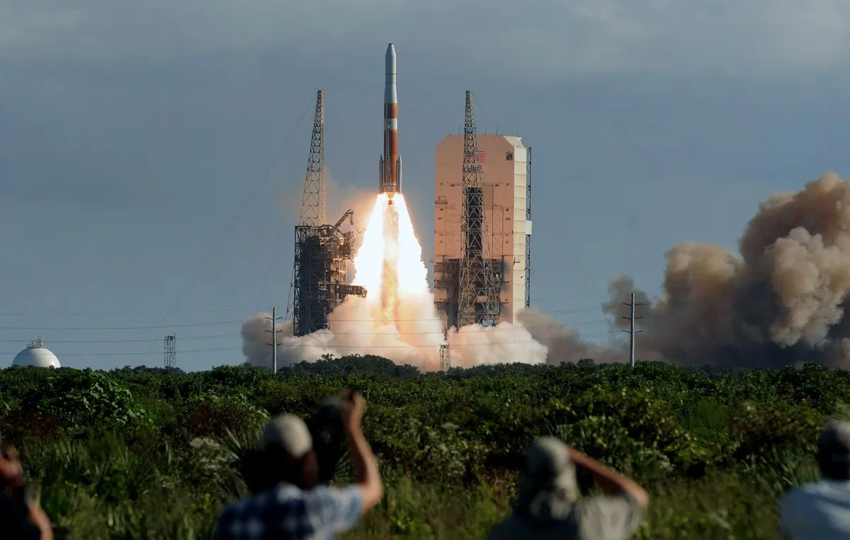
The very first Global Positioning System (GPS) satellite launched in February 1978, marking a new era of navigation by giving users an accurate pinpoint of their location back on Earth.
Today, it would be hard to imagine life without GPS and its many applications, from farming and package delivery to helping smartphone users find their nearest restaurant.
The architects of the GPS system, Dr Brad Parkinson, Professor James Spilker Jr, Hugo FrueHauf and Richard Schwartz, are the winners of the 2019 Queen Elizabeth Prize for Engineering.
We spoke to Dr Brad Parkinson, currently a professor at Stanford University, about the early development of GPS and where it might take us in the future.

How did the idea for GPS come about?
Early on I ended up leading the group that architected, developed, built and tested GPS in its infancy.
During that time we had some very traumatic experiences, but the project came out pretty much the way we had suggested it would. There were a number of innovations and a lot of very creative engineers.
As time has progressed, GPS has really become a system that’s taken for granted by people, and I think that’s a testament to its reliability and accuracy.
There was a gentleman named Ivan Getting, who was head of the Aerospace Corporation, and who prodded the airforce into looking into a new type of navigation system using satellites.
There had been some predecessor systems but they didn’t have much capability, so a study was done and 12 alternatives were examined during 1964 - 1966.
As time progressed, the usual thing happened. Any funding of a demonstration was postponed, there were other competing ideas, and about that time I came on board and was asked to advocate and gain approval for a system.
There’s no chance of GPS ever being turned off because the world’s infrastructure is so heavily dependent on it.
My first try was a total failure! I went before the Pentagon board and they unanimously voted it down.
But I had a mentor and he said “Brad, you go back and try again.” He wanted me to redesign it, so I did.
I called a meeting a long way from Los Angeles, where I was stationed, and I recruited 10 of the brightest and best airforce engineers that I had ever seen.
And at the end of a long weekend we came up with a design, and that design is the one you see today.
It had a number of innovations, including a brand new type of signal, including the use of atomic clocks in space, and including the idea that if you listened to four satellites at the same time, the user could do precise navigation and would not require a very precise clock.
That’s important because if you want to make it affordable, you can’t carry around an atomic clock on your wrist.

How did the launch of the Soviet Sputnik satellite, and indeed early US satellites, inform and inspire the launch of the first GPS satellites?
It’s interesting because Sputnik was launched in the autumn of 1957 and I was a fresh graduate of the US Naval Academy, so I can say I’m a child of the Space Age.
Throughout my personal career I taught space mechanics for the astronauts at the air academy and I’ve been an engineer on various space systems.
I would say that Sputnik was an eye-opener to the US. At the time of course it was deemed a defence threat, the idea that things were flying over head, and indeed there was some truth in that because the technology that launched it could also launch ICBMs (inter-continental ballistic missiles).
So naturally the country geared up and we went into intense technology mode from 1957 on. We started putting up things that could look and listen, and activate various sensors in space.
But it wasn’t until the mid-1960s that the Navy conceived of a navigation system, and they called it Transit.
Transit was quite a nice development, but it was periodic and not very accurate. About once every 2 or 3 hours you could get a fix, but it was not 3-dimensional.
It assumed that you knew where you were and in this case the Navy generally was operating on the surface of the ocean so they had the third dimension without any trouble.
But as time went on, it became apparent that there ought to be a better way, and we were seeking something that was really accurate.
At that time, ‘really accurate’ was about 10 metres. A study was performed, 12 alternatives were outlined, and when I held that meeting after I had failed to get approval, we selected the hardest of those alternatives.
But it also gave the greatest benefit because we did not require an atomic clock in the user receiver, and we had already done a series of tests in the desert that showed such a system could get an accuracy of 10 metres, worldwide, 24/7, not just in 2 dimensions, but also in altitude.
With that sort of system, the benefits to both military and civilian were pretty obvious.
There’s usually a statement in the histories - and the wrong histories, I might add - that GPS was a military system and only much later did civilians use it. Not so.
From the very beginning I testified before Congress, before we launched the first satellite, that the system had a civilian component that was going to be freely available, and by that time I’d already published the signal specifications so people could actually build such a receiver.
Curiously enough, the first civilian receiver to lock up on a GPS signal was built by students in the United Kingdom, at the University of Leeds under a Professor Peter Daly, and they did that on about the first orbit after we turned on the signal.
This is an illustration of the fact that GPS, from the beginning, had been dual purpose, although we did not guarantee it to the world.
However, when KAL007 was shot down, President Reagan said we would guarantee it to the world, and provide at least a 10-year notice before we turn it off.
There’s no chance of it ever being turned off because the world’s infrastructure is so heavily dependent on it.
Do the GPS satellites have implications for spaceflight or life on the International Space Station, for example?
When we put the first GPS satellite up I did a series of candidate drawings that showed how it could be used for navigation in cars, with the voice and the display notifications.
That had never been done before, and it couldn’t be done affordably because the microchips required had not yet been produced. But my vision was that all that could happen.
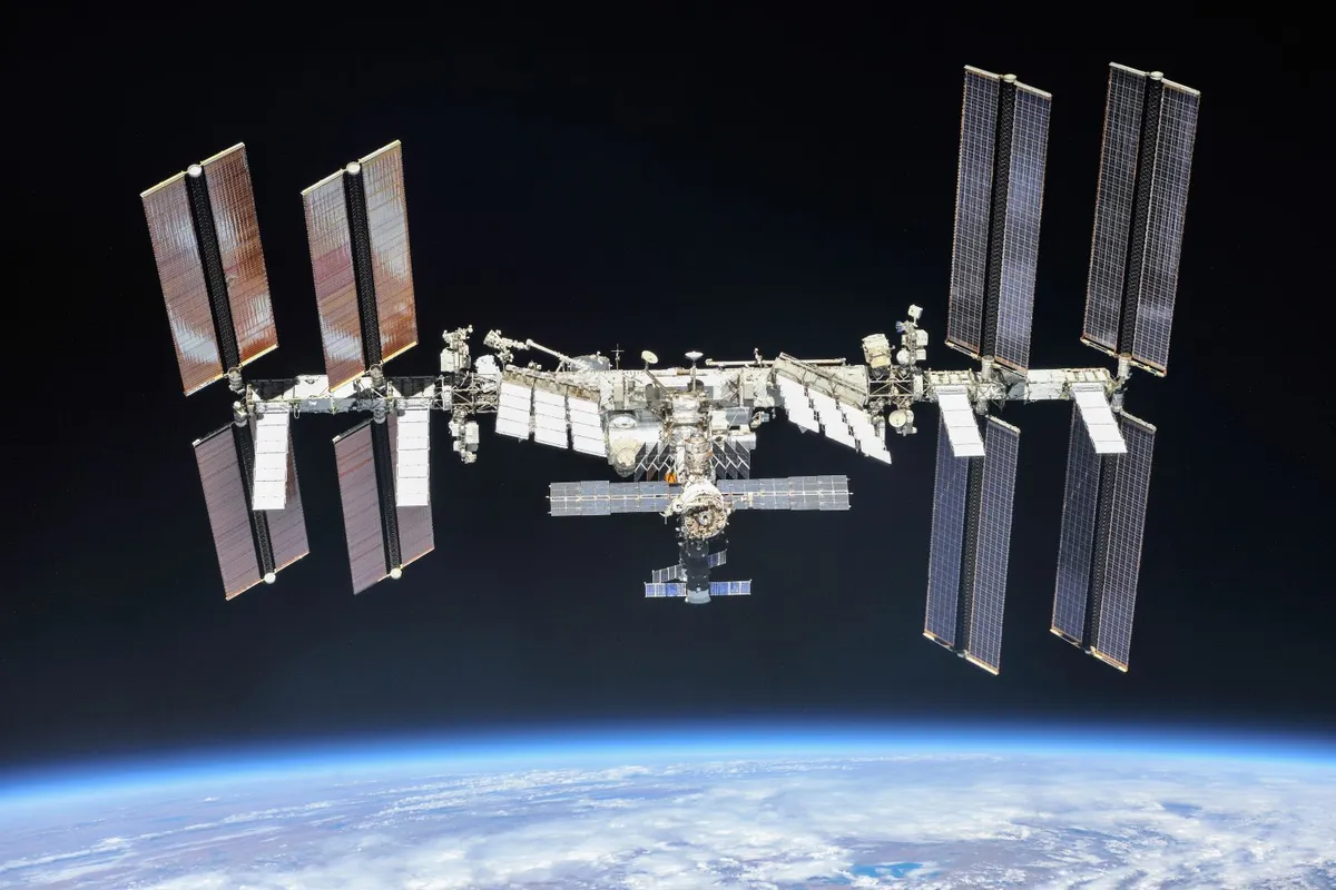
However, it never occurred to me that you could use GPS to also position objects in space, near Earth. For example, the Space Station has GPS receivers on it.
Many of the boosters that put satellites in orbit today use GPS. That whole concept is called Space Service Volume, and this refers to the amount of space around Earth, but not on Earth, where GPS is generally available.
NASA has now found a way, instead of using the main lobe of our radio signal, to get into the very faint side lobes that have perhaps 1% power, and they can still navigate.
As a matter of fact, they can navigate all the way out to beyond GPS orbits, and they believe they can navigate all the way to the Moon using GPS.
If someone had asked me if that were possible, I’d have said “I don’t think so,” but it turns out brilliant engineers have indeed put together solutions and produced GPS receivers that you put on spacecraft and very inexpensively allow that spacecraft to autonomously know exactly where it is.

How do GPS satellites launch, and what is their Earth orbit like?
If you think about the fact that you don’t want to pay for too many satellites, obviously you put the satellites up as high as you can so they’re visible from lots of places.
Back in 1975 when we conceived of this system we had a very inexpensive launcher called an Atlas ICBM, and the reason those were so inexpensive was that in the process of various arms reduction negotiations, we had a bunch of surplus Atlases.
So the next question was, if we have that as the first stage, how high can you put a reasonable satellite?
We concluded that we could go up to what we call ‘semi-synchronous’, i.e. half of 24 hours: 12 hours. This is roughly 11,000 miles above Earth.
So all GPS satellites and all the lookalike systems are in roughly the same orbital region. There are a couple of exceptions. China has put a few up that are in a geo-synchronous orbit, which is a 24-hour period.
People are talking about putting up thousands of satellites. They may have a good purpose but to me they sure look like garbage!
The reason we’re in the altitude we are was pretty much constrained by the booster we had at the time. But it’s a little more complicated because you still need to ask yourself what inclination to the equator that orbital plane should be in, and whether the orbit should be circular or elliptical.
We discovered that the best answer was circular orbits at around 63° inclination.
The way we have been doing it in the US for some time is, nominally there are 6 orbital planes, uniformly spaced around Earth, and each has 4 uniformly distributed satellites in them, for a nominal total of 24.
We originally built the satellites to have a lifetime of about 3-5 years, but many of the older satellites have had 20-year lifetimes.
One of the things that astonishes me - and I’m very proud of the engineers who did it, one of whom is a winner of the Queen Elizabeth Prize for Engineering this year, Hugo Fruehauf - engineered a space clock that would last.
This is an atomic clock that is put in the upper Van Allen Belt, which humans would not survive unprotected due to the radiation. It is an extremely hot area.
And yet, our electronics and that particular design of atomic clock have survived for over 20 years in many cases.
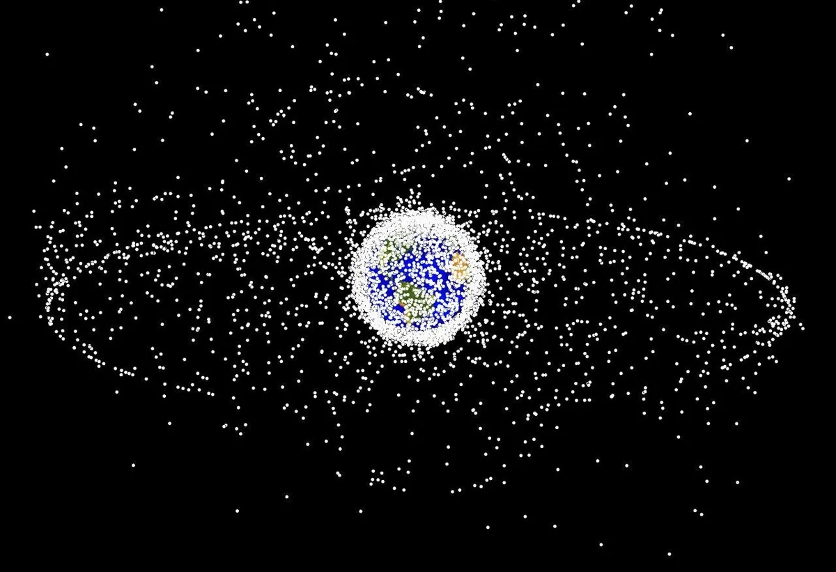
Is there a danger of the accumulation of so-called space junk, especially if we’re looking to send humans back to the Moon and perhaps to Mars?
I think there’s a perception that somehow the satellites will eventually decay in their orbits and eventually crash down on Earth. At our altitudes that will take probably 100s of 1000s of years. It just wouldn’t happen without some intervention.
Once GPS satellites are retired, they are boosted up to a higher orbit, and they’re going to be there until we figure out some way to get them down.
That bothers me a lot. I liken it to somebody throwing all their junk into the back yard and hoping it will all rust away. These satellites will not rust away.
In terms of orbital debris, the real concern is the low Earth orbits. People are talking about putting up thousands of satellites. They may have a good purpose but to me they sure look like garbage!
There is an answer, however. We could reach an international agreement that we put nothing up at altitudes under 1,000 miles that does not have the capability to thrust and dig back into the atmosphere, come down and burn up.
It would require them having a reserve propulsion power, but not a lot, because all you need to do is change the eccentricity slightly and you can get the satellite down into a position where the orbit will rapidly decay.
I chaired the NASA Advisory Council for 6.5 years, and one of the pieces of advice that I gave was that we have to do something to get a hold on the orbital debris problem.
I do not worry about it particularly for GPS. There are relatively few satellites, and the ones that are used up are pushed into an orbit where it’s almost impossible for them to hit something, including an astronaut or anything else.
Space is vast, so we have that as an advantage. But if you look at the accumulation of debris in the orbits from about 100-300 miles, frankly it’s pretty scary.
You worry that a single collision could create a chain reaction. If it hits hard enough, other pieces could start a cascading effect much as a runaway nuclear reactor might do.

If we’re interested in creating permanent human settlements on the Moon or Mars, would it be possible to launch GPS satellites in orbit around those bodies?
It certainly is possible to replicate some sub-version of GPS around the Moon or Mars.If you were to do that, the need is presumably not continuous, it’s not the same as landing an aeroplane, necessarily.
You’d want to do it as inexpensively as you could and still meet whatever your particular needs are.
I would suggest they go back and look at the old Navy system, which could get by pretty much with a single satellite.
It won’t give you the accuracy but it would certainly pin things down to 1/10th of a mile. That might be the best way to do it.
But if you’re going to look to the future, to me the exciting part is the whole business of robotic vehicles, which is coming. We keep reading about it.
In the US, I can foresee long-haul trucks all being converted to un-humaned operation. We have demonstrated it already. The savings in productivity are enormous.
If you’ve ever gone on a long trip and actually had to drive for 10 or 12 hours, your mind has real problems.
But truck drivers do this day after day after day. Trucks are pretty safe: they do a pretty good job. Nonetheless, when they have accidents they’re usually spectacular.
We have the technology using GPS, road sensors, radars, vehicle to vehicle communications, to put in place fully robotic long haul trucking.
Another big thing that’s coming is the unmanned aerial system, UAS, which again requires highly reliable, robust, positioning navigation and time.
As these UASs become proliferated, you end up with a concern, which is how we are monitoring and controlling them, and what the safety implications are.
I think the sooner we come up with solutions for these problems, the better we’re all going to be.
But I think ultimately we’re becoming too dependent on GPS. The old-fashioned map is still alive and well, and I find that even myself, who relies on GPS to get from A to B in my car, I find that I lose what I used to do, which is landmark navigation.
I used to think “at the filling station you take a right, then you go down to the school and take a left and you’re there.”
I find I just don’t activate that any more. I think that’s wrong, and that we all should not give up on spatial awareness easily.
I do a lot of bareboating on the Caribbean and my kids laugh at me because I’m busy sighting on the land and watching the depth gauge, plotting my position on a chart, and they say “why are you doing all that?”
And I say “I’m not going to just rely on that GPS system!”

