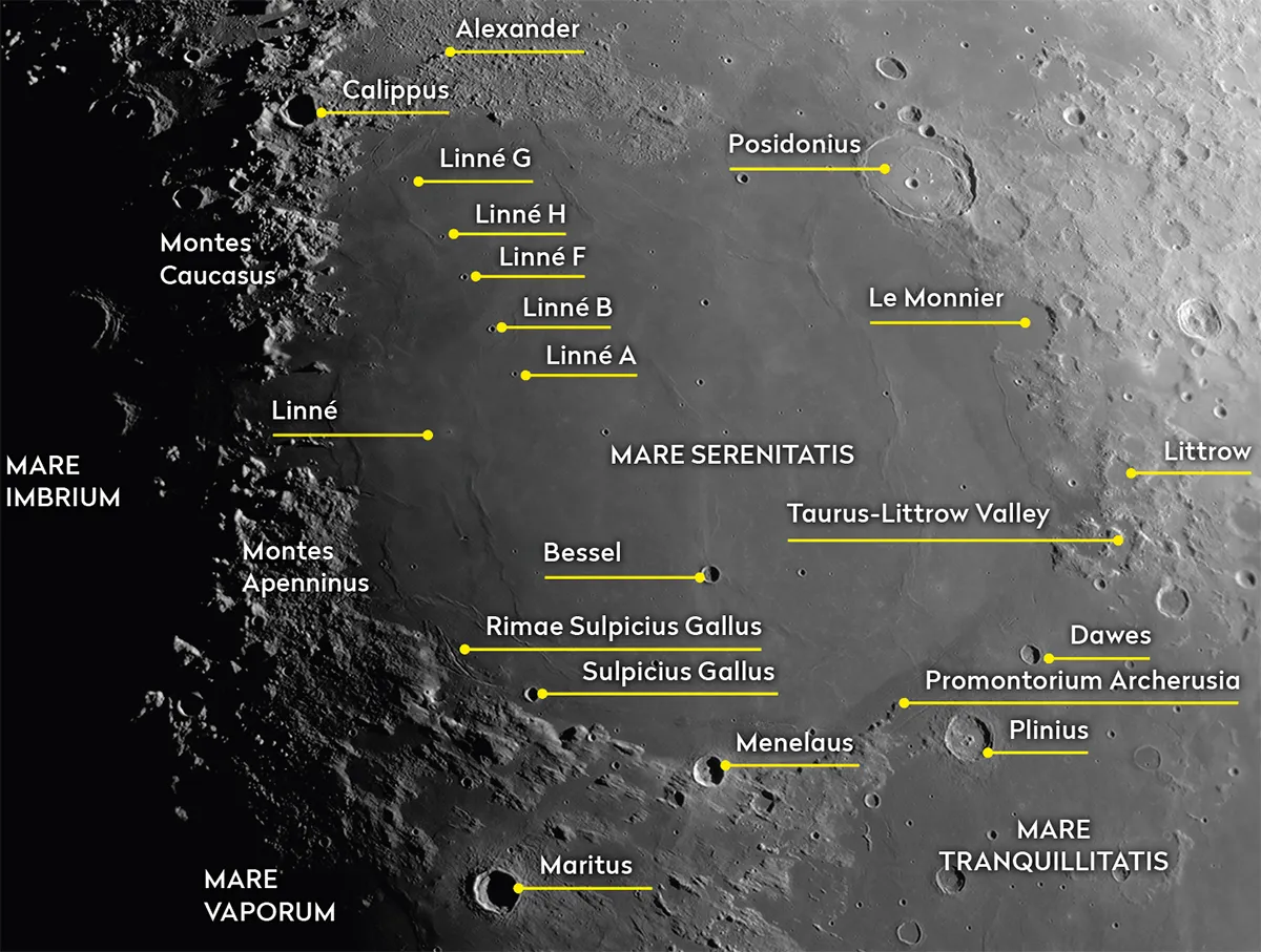
Mare Serenitatis is one of the primary dark lava seas on the Earth-facing side of the Moon. The ‘Sea of Serenity’ makes a good pair with neighbouring 700km Mare Tranquillitatis, the ‘Sea of Tranquillity’.
Serenitatis is roughly circular and sits between Mare Imbrium to the west and Mare Tranquillitatis to the southeast. Less well defined to the southwest is Mare Vaporum.
To its north sits Lacus Mortis, the Lake of Death.
For more lunar observing advice, read our guides on how to observe the Moon and the best features on the Moon.
Facts about Mare Serenitatis
- Size: 650km
- Longitude/latitude: 18.4˚ E, 27.3˚ N
- Age: 3.9 billion years
- Best time to see: Five days after new Moon (20–22 November) and four days after full Moon (5–7 November)
- Minimum observing equipment: Naked eye
To the northeast Serenitatis overspills into an irregular region north of 96km Posidonius, a crater that appears to have an inner floor tilted up in the east.
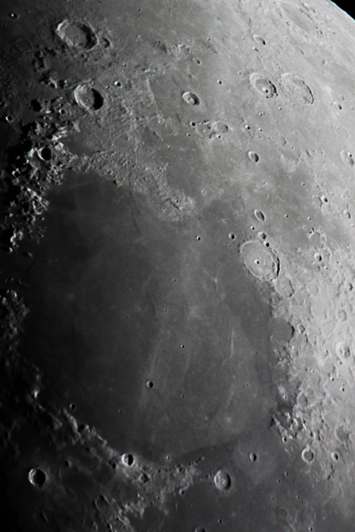
South of Posidonius is the dark, circular but broken form of 61km Le Monnier, resembling a less impressive version of the 400km x 260km Sinus Iridum, the ‘Bay of Rainbows’, located on the northwest shore of 1,250km Mare Imbrium.
Le Monnier is a crater infilled with lava from Mare Serenitatis.
South of Le Monnier lies a complex area around 31km Littrow, which consists of elevated highlands interspersed with flat, lowland lava.
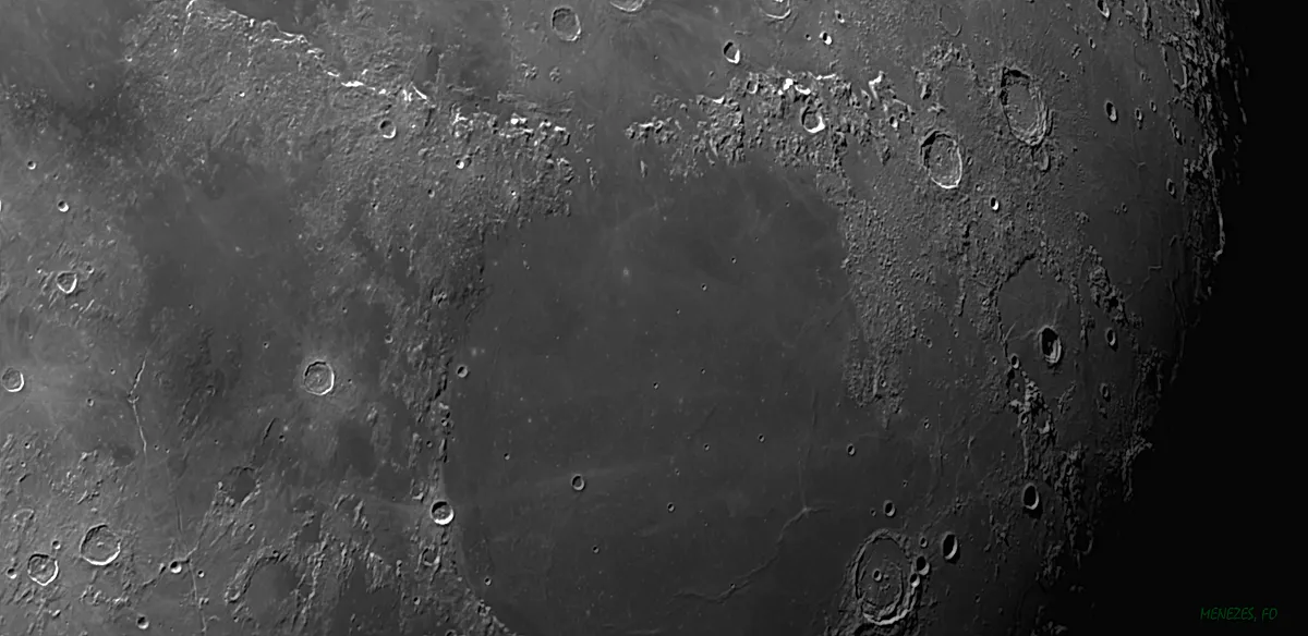
The 30km Taurus-Littrow Valley is in the region south of Littrow, marking the location of the last human presence on the Moon, the Apollo 17 landing site.
Continuing south brings us to the border between Mare Serenitatis and Mare Tranquillitatis.
A strong contrast between the darker lava of Tranquillitatis and the lighter material of Serenitatis is very apparent here, with the latter being the younger of the two lunar maria.
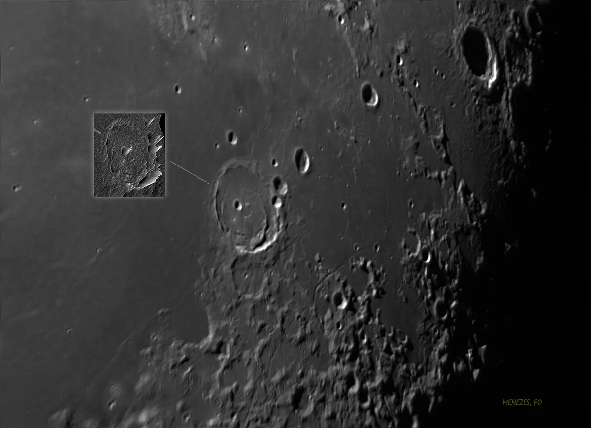
The craters Dawes (18km) and Plinius (43km) are all that sit in the 200km-wide region where Serenitatis meets Tranquillitatis.
The western end of the gap is terminated by a pointed feature known as Promontorium Archerusia, arcing toward 27km crater Menelaus.
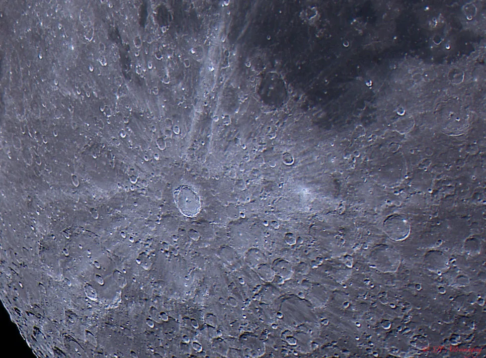
Running across Serenitatis’s surface, north-northeast through 17km Bessel, is a bright ejecta ray from 86km Tycho Crater, located 2,000km south-southwest.
If we continue northwest around Serenitatis’s border we come to 12km Sulpicius Gallus, a crater marking the start of an impressive set of rilles, or narrow channels, expanding like the branches of a tree northwest.
The rilles are known as Rimae Sulpicius Gallus.
Approaching the border with Mare Imbrium, we first pass the foothills of the Apennine mountains to the west.
The seas join where a 75km gap sits between Montes Apenninus to the south and Montes Caucasus to the north.
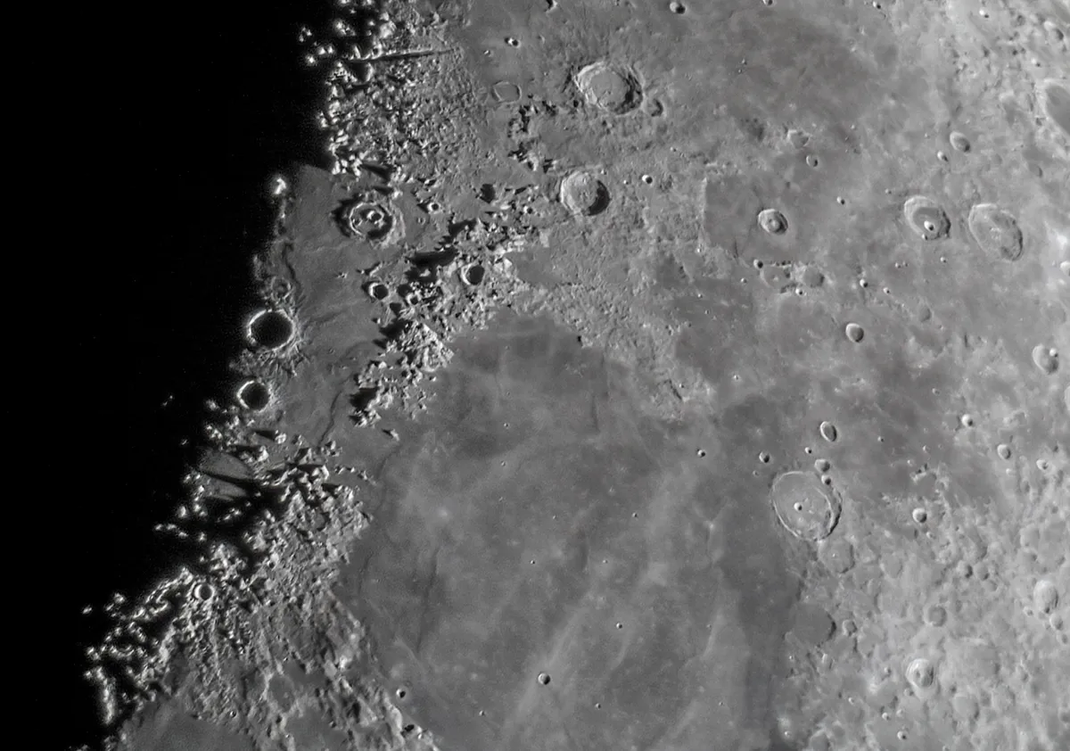
The Caucasus range continues north, a round hilly area to the east of the 33km crater Calippus marking Serenitatis’s northern border.
A curiosity is visible just south of where Montes Caucasus merges with the hilly region, running south of the eroded 82km crater Alexander.
Here you’ll find a 210km linear arrangement of small craters. Starting at 5km Linné G to the north, head south past 3km Linné H, 5km Linné F, 5km Linné B and 4km Linné A.
Next, we travel 80km west-southwest from Linné A to locate the 3km crater Linné, which is surrounded by bright ejecta. Once thought to be bowl-shaped, the crater is now known to have the shape of a flattened, inverted cone.
